The structure, format and content of IENC – Inland Electronic Navigational Charts is standardised. They are issued by the authorized institutions for the purpose of using them in imaging electronic maps and navigational information from Inland ECDIS.
The structure, format and content of IENC – Inland Electronic Navigational Charts is standardised. They are issued by the authorized institutions for the purpose of using them in imaging electronic maps and navigational information from Inland ECDIS.
The standardised map products meet the criteria of technical specification for Inland ECDIS (Elec-tronic Chart Display and Information System). Thanks to this, they are a part of the ECDIS system on a unit performing navigation in a paper-free form.
An IENC map contains all the information necessary for a safe navigation. Thanks to having addi-tional information at its disposal, it improves the quality of navigation. In order to ensure the safe navigation, IENC maps should contain the following data layers:
coastline,
shoreline structures that may cause an accident,
the contours of watergates and weirs,
waterway borders,
waterway axis along with the distance measured in kilometres or hectometres,
navigation aids, such as: leading lights, buoys, marks and beacons,
individual dangers.
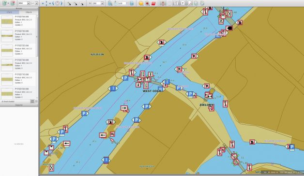
Thanks to the Pilot Implementation of The Lower Oder RIS from Ognica town to Szczecin, the waterway users may use the inland electronic charts for this part free of charge. The map below is an excerpt from a electronic navigation chart showing the Szczecin area.